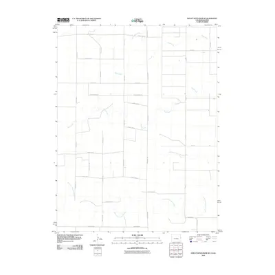
2010 Map of Mount Sunflower NE
USGS Topo · Published 2010About this map
The North Fork Smoky Hill River meanders across the southern landscape of this high plains region, defining the drainage patterns of Wallace County near the Colorado border. This 2010 survey reflects a strictly rural agricultural section of Weskan Township, where the terrain is segmented by a precise grid of maintained thoroughfares such as County Road G and County Road R. The hydrology of the area is characterized by ephemeral and intermittent waterways, including the headwaters of Sappa Creek, South Beaver Creek, and the extensive reaches of Sandy Creek. The map documents a sparsely populated area where large-scale land management is indicated by the systematic road network, providing a clear view of the ranching and farming infrastructure just north of the Smoky Hill River valley.
Find a feature on this map
27 named features on this map. Tap any name to fly to it.
Don’t see what you’re looking for? This feature index may not catch every label — zoom into the map to look around manually.
Map Details
Editions of this 2010 Mount Sunflower NE Map
This is the sole edition of this map. No revisions or reprints were ever made.
Other maps of this area

1954 · Limon
USGS Topo · 1:250,000

1954 · Goodland
USGS Topo · 1:250,000

1956 · Goodland
USGS Topo · 1:250,000

1957 · Limon
USGS Topo · 1:250,000

1957 · Goodland
USGS Topo · 1:250,000

1958 · Limon
USGS Topo · 1:250,000

1959 · Horsethief Draw
USGS Topo · 1:62,500

1966 · Ruleton
USGS Topo · 1:24,000

1969 · Mount Sunflower SW
USGS Topo · 1:24,000
1969 · Mount Sunflower
USGS Topo · 1:24,000