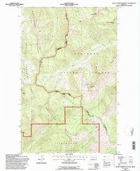
1994 Map of Mount Thompson-Seton
USGS Topo · Published 1997About this map
Whitefish Range peaks and high-altitude drainage basins define this portion of the northern Rockies near the boundary of Flathead Co and Lincoln Co. The landscape is characterized by prominent summits like Mount Thompson-Seton and Mount Petery, which overlook a complex network of glacial-fed streams. The Stillwater River and North Fork Stillwater River collect the runoff from the southern slopes, while Whale Creek and Yakinikak Creek carve through the northern drainages.
Find a feature on this map
32 named features on this map. Tap any name to fly to it.
Don’t see what you’re looking for? This feature index may not catch every label — zoom into the map to look around manually.
Map Details
Editions of this 1994 Mount Thompson-Seton Map
This is the sole edition of this map. No revisions or reprints were ever made.
Other maps of this area

1913 · Stryker
USGS Topo · 1:125,000

1916 · Stryker
USGS Topo · 1:125,000

1957 · Kalispell
USGS Topo · 1:250,000

1960 · Kalispell
USGS Topo · 1:250,000

1961 · Kalispell
USGS Topo · 1:250,000

1963 · Mount Marston
USGS Topo · 1:24,000

1963 · Stryker
USGS Topo · 1:24,000

1963 · Stahl Peak
USGS Topo · 1:24,000

1966 · Red Meadow Lake
USGS Topo · 1:24,000
1966 · Bull Lake
USGS Topo · 1:24,000