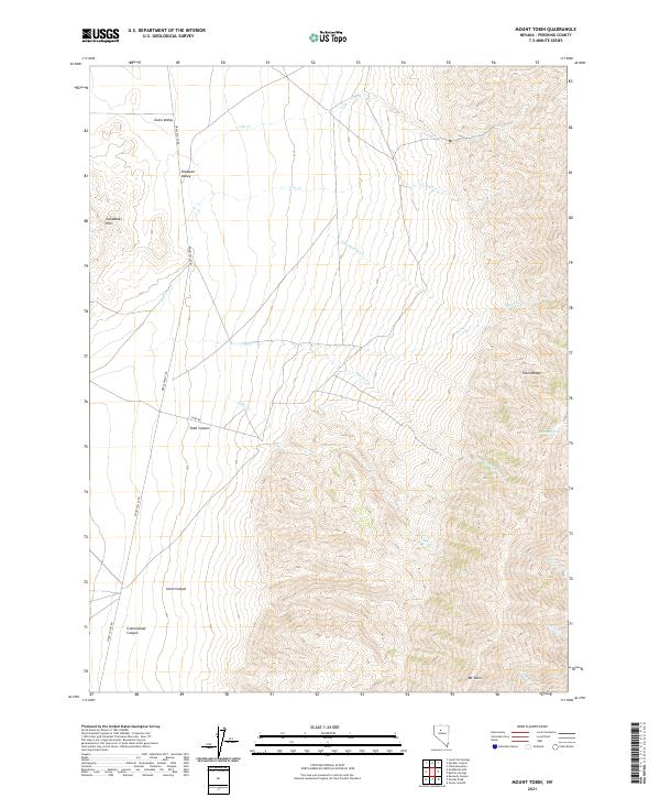
2021 Map of Mount Tobin
USGS Topo · Published 2021About this map
Mt Tobin serves as the dominant high point in this high-desert landscape of Pershing County, where the southern portion of the Tobin Range meets the expansive drainage basins of Grass Valley and Pleasant Valley. The terrain is defined by a network of seasonal watercourses and springs that have long dictated the movement of people and livestock through these arid basins. Notable features include Summit Spring nestled high in the range and the deep incisions of Siard Canyon and Cottonwood Canyon which provide natural corridors through the steep topography.
Find a feature on this map
24 named features on this map. Tap any name to fly to it.
Don’t see what you’re looking for? This feature index may not catch every label — zoom into the map to look around manually.
Map Details
Editions of this 2021 Mount Tobin Map
This is the sole edition of this map. No revisions or reprints were ever made.
Other maps of this area

1932 · Sonoma Range
USGS Topo · 1:250,000

1939 · Sonoma Range
USGS Topo · 1:250,000

1955 · Winnemucca
USGS Topo · 1:250,000

1958 · Winnemucca
USGS Topo · 1:250,000

1961 · Mt. Tobin
USGS Topo · 1:62,500

1961 · Leach Hot Springs
USGS Topo · 1:62,500

1962 · Winnemucca
USGS Topo · 1:250,000

1962 · Buffalo Springs
USGS Topo · 1:62,500
1965 · China Mountain
USGS Topo · 1:24,000

1982 · Fish Creek Mts
USGS Topo · 1:100,000