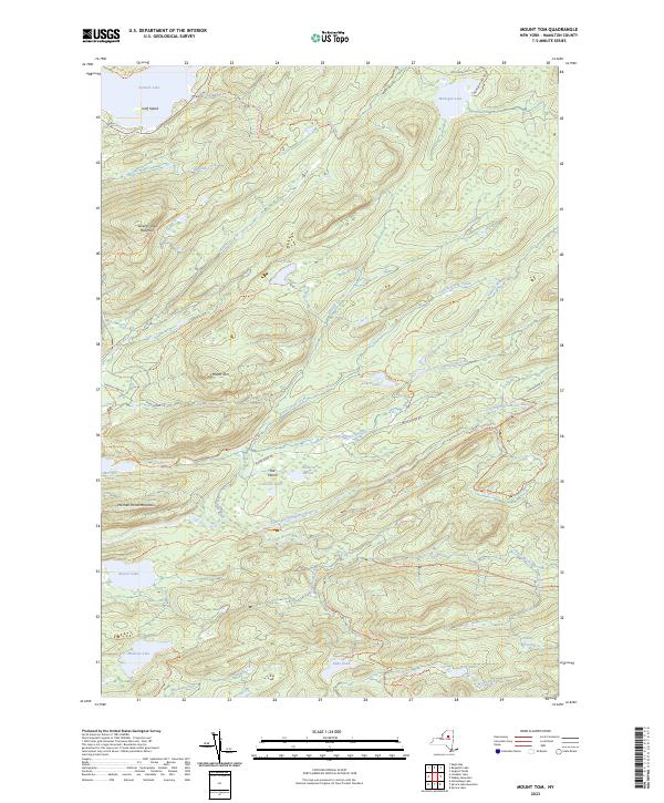
2023 Map of Mount Tom
USGS Topo · Published 2023About this map
Mount Tom and Seventh Lake Mountain dominate this landscape in Hamilton County, where a dense network of water bodies and tributary streams defines the drainage patterns of the Central Adirondacks. The map details an extensive system of backcountry trails, including the Seventh Lake Mountain Multiple-Use Trl and the Brooktrout Lake Trl, reflecting the area's modern identity as a managed wilderness. A notable concentration of small basins and ponds, such as Icehouse Pond, Helldiver Pond, and the Mitchell Ponds, are situated near The Plains, a distinctive low-lying feature along the South Branch Moose River. Towards the south, the terrain shifts into a series of larger water features, including Beaver Lake, Muskrat Lake, and Wolf Lake, connected by named drainages like Otter Brook and Wolf Creek. This survey provides a precise record of contemporary recreation infrastructure within this wooded mountain corridor.
Find a feature on this map
51 named features on this map. Tap any name to fly to it.
Don’t see what you’re looking for? This feature index may not catch every label — zoom into the map to look around manually.
Map Details
Editions of this 2023 Mount Tom Map
This is the sole edition of this map. No revisions or reprints were ever made.
Other maps of this area

1900 · Canada Lake
USGS Topo · 1:62,500

1901 · Old Forge
USGS Topo · 1:62,500

1903 · Big Moose
USGS Topo · 1:62,500

1903 · West Canada Lakes
USGS Topo · 1:62,500

1903 · Raquette Lake
USGS Topo · 1:62,500

1950 · Utica
USGS Topo · 1:250,000

1954 · Old Forge
USGS Topo · 1:62,500

1954 · West Canada Lakes
USGS Topo · 1:62,500
1954 · Raquette Lake
USGS Topo · 1:62,500

1954 · Big Moose
USGS Topo · 1:62,500