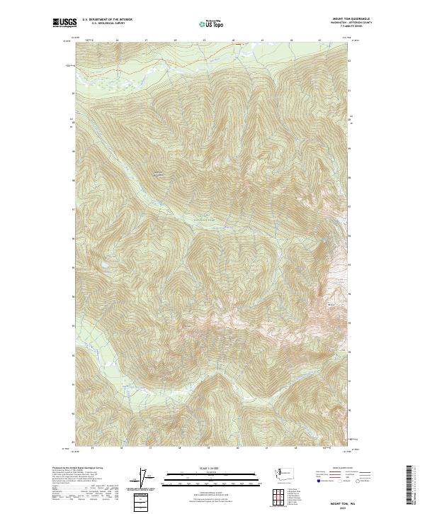
2023 Map of Mount Tom
USGS Topo · Published 2023About this map
The Olympic Mountains dominate this high-elevation quadrangle, where the high peaks of Mt Tom and Hoh Peak define the hydrological divide. In this wilderness landscape, glacial movement and alpine hydrology are visible through features like White Glacier and the headwaters of the Hoh River. The terrain is characterized by steep elevation changes and deep drainages carved by Mount Tom Creek and Cougar Creek, illustrating the glacial morphology of the Pacific Northwest.
Find a feature on this map
20 named features on this map. Tap any name to fly to it.
Don’t see what you’re looking for? This feature index may not catch every label — zoom into the map to look around manually.
Map Details
Editions of this 2023 Mount Tom Map
This is the sole edition of this map. No revisions or reprints were ever made.
Other maps of this area

1935 · Mount Olympus
USGS Topo · 1:62,500

1939 · Mount Tom
USGS Topo · 1:62,500

1942 · Mount Olympus
USGS Topo · 1:62,500

1947 · Mt Christie
USGS Topo · 1:62,500

1950 · Mt Christie
USGS Topo · 1:62,500

1950 · Slide Peak
USGS Topo · 1:24,000
1950 · Bogachiel Peak
USGS Topo · 1:24,000
1950 · Mount Carrie
USGS Topo · 1:24,000

1956 · Mount Olympus
USGS Topo · 1:62,500

1956 · Kloochman Rock
USGS Topo · 1:62,500