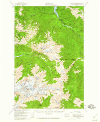
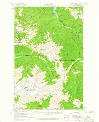
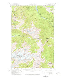
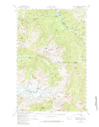
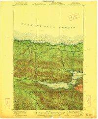
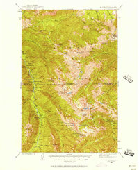
1956 Map of Mount Olympus
USGS Topo · Published 1960About this map
Olympic Hot Springs and a network of remote backcountry shelters define this mid-century survey of the high Olympics. The landscape is dominated by the massive ice fields of Mount Olympus, including the Blue Glacier and Hoh Glacier, which feed the headwaters of the Hoh River and Queets River. This map captures the area shortly after the mid-1950s field checks, showing established trail infrastructure like the Hurricane Hill Lookout Trail and several shelters such as Idaho Shelter and Lillian Shelter.
Find a feature on this map
75 named features on this map. Tap any name to fly to it.
Don’t see what you’re looking for? This feature index may not catch every label — zoom into the map to look around manually.
Map Details
Editions of this 1956 Mount Olympus Map
4 editions found
Other maps of this area
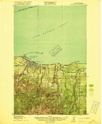
1918 · Port Angeles
USGS Topo · 1:62,500

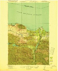
1918 · Lake Crescent
USGS Topo · 1:62,500
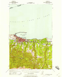
1919 · Port Crescent
USGS Topo · 1:62,500
1922 · Lake Crescent
USGS Topo · 1:62,500

1935 · Mount Olympus
USGS Topo · 1:62,500

1938 · Mt Constance
USGS Topo · 1:125,000

1939 · Mount Tom
USGS Topo · 1:62,500
1941 · Port Angeles
USGS Topo · 1:62,500

1942 · Mount Olympus
USGS Topo · 1:62,500
1944 · Mt. Angeles
USGS Topo · 1:62,500