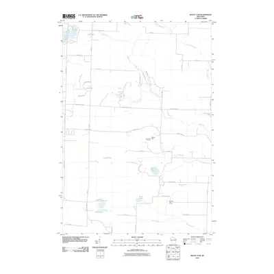
2010 Map of Mount Tom
USGS Topo · Published 2010About this map
Mount Tom and its namesake Mount Tom Fire Tower dominate the central landscape of this Marinette County region. The terrain is defined by an intricate network of waterways, including the winding Middle Inlet, Plumadore Creek, and Medicine Brook. These watercourses feed numerous small bodies of water such as Newton Lake, Star Lake, and Retcof Lake. The infrastructure reflects a rural recreation and timber-rich environment, with numerous roads named after local families or geographical features, such as Nejedlo Rd, Bizjak Ln, and Moonshine Hill Rd. To the south, the presence of the Sundown Golf Course near Rush Lake indicates the shift towards modern leisure use in this Northwoods landscape.
Find a feature on this map
46 named features on this map. Tap any name to fly to it.
Don’t see what you’re looking for? This feature index may not catch every label — zoom into the map to look around manually.
Map Details
Editions of this 2010 Mount Tom Map
This is the sole edition of this map. No revisions or reprints were ever made.
Other maps of this area

1939 · Porterfield
USGS Topo · 1:48,000

1940 · Athelstane
USGS Topo · 1:48,000

1941 · Coleman
USGS Topo · 1:48,000

1942 · Athelstane
USGS Topo · 1:48,000

1942 · Coleman
USGS Topo · 1:48,000

1942 · Porterfield
USGS Topo · 1:48,000

1942 · Wausaukee
USGS Topo · 1:48,000

1947 · Wausaukee
USGS Topo · 1:48,000

1950 · Coleman
USGS Topo · 1:48,000

1954 · Iron Mountain
USGS Topo · 1:250,000