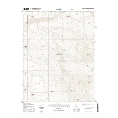
2014 Map of Mount Tukuhnikivatz
USGS Topo · Published 2014About this map
Mt Tukuhnikivatz dominates the eastern high ground of this landscape within the Manti-La Sal National Forest, marking a dramatic vertical transition from the lower Spanish Valley to the north. The area is defined by a complex network of canyons and ridges, including Hell Canyon, Dorry Canyon, and Brumley Ridge, which channel drainage into watercourses like Pack Cr and Mill Cr. This 2014 survey captures the high-altitude infrastructure of the La Sal Mountains, showing the Gold Basin Tower and the critical mountain passes like La Sal Pass.
Find a feature on this map
40 named features on this map. Tap any name to fly to it.
Don’t see what you’re looking for? This feature index may not catch every label — zoom into the map to look around manually.
Map Details
Editions of this 2014 Mount Tukuhnikivatz Map
This is the sole edition of this map. No revisions or reprints were ever made.
Other maps of this area

1885 · La Sal
USGS Topo · 1:250,000

1954 · Mt. Waas 4 SW
USGS Topo · 1:24,000

1954 · Mt Peale 1 SW
USGS Topo · 1:24,000

1954 · Mt Peale 1 NW
USGS Topo · 1:24,000

1954 · Mt Peale 2 SW
USGS Topo · 1:24,000

1954 · Mt Peale 2 NW
USGS Topo · 1:24,000

1954 · Mt Peale 2 SE
USGS Topo · 1:24,000

1954 · Mt. Waas 3 SE
USGS Topo · 1:24,000

1954 · Mt Peale 2 NE
USGS Topo · 1:24,000

1954 · Mt. Waas 3 SW
USGS Topo · 1:24,000