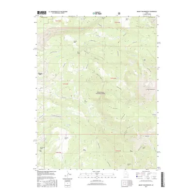
2017 Map of Mount Tukuhnikivatz
USGS Topo · Published 2017About this map
Mount Tukuhnikivatz dominates the eastern skyline of this high-elevation terrain, situated within the protected boundaries of the Manti-LaSal National Forest. The landscape is defined by a complex network of canyons and ridges, where Dorry Canyon and Hell Canyon carve through the uplifted topography. To the northwest, the edge of the Spanish Valley provides a lower-altitude counterpoint to the towering peaks.
Find a feature on this map
45 named features on this map. Tap any name to fly to it.
Don’t see what you’re looking for? This feature index may not catch every label — zoom into the map to look around manually.
Map Details
Editions of this 2017 Mount Tukuhnikivatz Map
This is the sole edition of this map. No revisions or reprints were ever made.
Other maps of this area

1885 · La Sal
USGS Topo · 1:250,000

1954 · Mt. Waas 4 SW
USGS Topo · 1:24,000

1954 · Mt Peale 1 SW
USGS Topo · 1:24,000

1954 · Mt Peale 1 NW
USGS Topo · 1:24,000

1954 · Mt Peale 2 SW
USGS Topo · 1:24,000

1954 · Mt Peale 2 NW
USGS Topo · 1:24,000

1954 · Mt Peale 2 SE
USGS Topo · 1:24,000

1954 · Mt. Waas 3 SE
USGS Topo · 1:24,000

1954 · Mt Peale 2 NE
USGS Topo · 1:24,000

1954 · Mt. Waas 3 SW
USGS Topo · 1:24,000