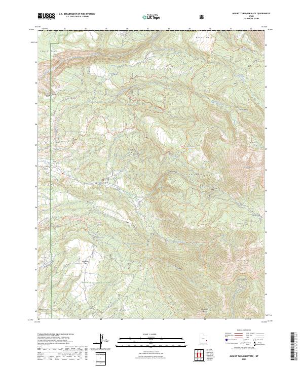
2023 Map of Mount Tukuhnikivatz
USGS Topo · Published 2023About this map
Mt Tukuhnikivatz and the high peaks of the La Sal Mountains dominate this 2023 survey of San Juan County. The terrain is a complex network of glacial basins and deep canyons, including Gold Basin and Dorry Canyon, all situated within the Manti-La Sal National Forest. High-altitude passes like Geyser Pass and La Sal Pass connect these drainages, serving as critical transit points through the alpine landscape. The map reveals a dense system of historic and modern routes such as the Wilson Mesa Rd and Boren Mesa Trl.
Find a feature on this map
47 named features on this map. Tap any name to fly to it.
Don’t see what you’re looking for? This feature index may not catch every label — zoom into the map to look around manually.
Map Details
Editions of this 2023 Mount Tukuhnikivatz Map
This is the sole edition of this map. No revisions or reprints were ever made.
Other maps of this area

1885 · La Sal
USGS Topo · 1:250,000

1954 · Mt. Waas 4 SW
USGS Topo · 1:24,000

1954 · Mt Peale 1 SW
USGS Topo · 1:24,000

1954 · Mt Peale 1 NW
USGS Topo · 1:24,000

1954 · Mt Peale 2 SW
USGS Topo · 1:24,000

1954 · Mt Peale 2 NW
USGS Topo · 1:24,000

1954 · Mt Peale 2 SE
USGS Topo · 1:24,000

1954 · Mt. Waas 3 SE
USGS Topo · 1:24,000

1954 · Mt Peale 2 NE
USGS Topo · 1:24,000

1954 · Mt. Waas 3 SW
USGS Topo · 1:24,000