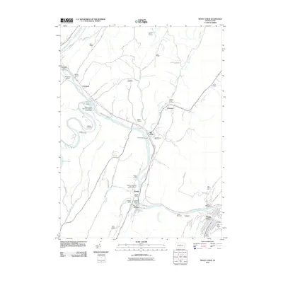
2010 Map of Mount Union
USGS Topo · Published 2010About this map
Mount Union and Mapleton sit along a sharp bend of the Juniata River, where the water cuts through the ridge at Jacks Narrows. This corridor is dense with industrial and genealogical history, featuring the Lucy Furnace site and the Dark Hollow Dam. The landscape is a complex network of hollows like Numer Hollow and Maley Hollow, with numerous family and fraternal burial grounds including the Campbell Family Cemetery and the Mapleton Independent Order of Odd Fellows Cemetery. These small, localized cemeteries are scattered throughout the hills, reflecting the deep-rooted settlement patterns of Huntingdon County. The confluence of the Raystown Branch Juniata River and the main stem near Ardenheim creates a focal point for water-based activity, supported by the Pennsylvania Fish Commission Access Area. Further north, smaller hamlets like Mill Creek and Fousetown line the tributary streams, maintaining their distinct identities amidst the rugged terrain of Bark Ridge and Lick Ridge.
Find a feature on this map
75 named features on this map. Tap any name to fly to it.
Don’t see what you’re looking for? This feature index may not catch every label — zoom into the map to look around manually.
Map Details
Editions of this 2010 Mount Union Map
This is the sole edition of this map. No revisions or reprints were ever made.
Other maps of this area

1901 · Huntingdon
USGS Topo · 1:62,500

1904 · Huntingdon
USGS Topo · 1:62,500

1919 · Menno
USGS Topo · 1:62,500

1922 · Mt Union
USGS Topo · 1:48,000

1923 · Tyrone
USGS Topo · 1:62,500

1924 · Mt. Union
USGS Topo · 1:62,500

1929 · Tyrone
USGS Topo · 1:48,000

1933 · Tyrone
USGS Topo · 1:62,500

1935 · Allensville
USGS Topo · 1:62,500

1938 · Allensville
USGS Topo · 1:62,500