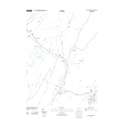
2013 Map of Mount Union
USGS Topo · Published 2013About this map
The Juniata River carves a deep path through the Ridge and Valley province of central Pennsylvania, anchored by the industrial and transport hub of Mount Union. This corridor, dominated by the William Penn Hwy and the historical movement of goods through the gaps of Jacks Narrows, links several riverside settlements including Mapleton and Mill Creek. The map documents a landscape where industry and topography meet, evidenced by the location of Lucy Furnace and the winding course of Raystown Br Juniata River near the edge of Raystown Lake. Further inland, family and place-named features like Smith Valley, Hill Valley, and Bark Ridge reflect the agricultural and rural character that persists away from the river banks. From the Corbin Bridge crossing to the Mountain Hide-Away Airport, the survey provides a detailed record of the road networks and watercourses, such as Saddler Cr and Hares Valley Cr, that define Huntingdon County’s terrain.
Find a feature on this map
77 named features on this map. Tap any name to fly to it.
Don’t see what you’re looking for? This feature index may not catch every label — zoom into the map to look around manually.
Map Details
Editions of this 2013 Mount Union Map
This is the sole edition of this map. No revisions or reprints were ever made.
Other maps of this area

1901 · Huntingdon
USGS Topo · 1:62,500

1904 · Huntingdon
USGS Topo · 1:62,500

1919 · Menno
USGS Topo · 1:62,500

1922 · Mt Union
USGS Topo · 1:48,000

1923 · Tyrone
USGS Topo · 1:62,500

1924 · Mt. Union
USGS Topo · 1:62,500

1929 · Tyrone
USGS Topo · 1:48,000

1933 · Tyrone
USGS Topo · 1:62,500

1935 · Allensville
USGS Topo · 1:62,500

1938 · Allensville
USGS Topo · 1:62,500