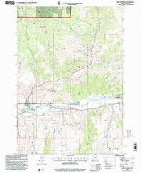
1998 Map of Mount Vernon
USGS Topo · Published 2000About this map
The John Day River valley dominates this late 20th-century landscape, where industrial history and natural landmarks converge near the settlement of Mount Vernon. The presence of extensive Dredge Tailings along the riverbanks serves as a visible marker of past gold dredging operations that reshaped the valley floor. To the north, the terrain rises into the Malheur National Forest, characterized by numerous spring-fed drainages like Gordon Creek and Beech Creek. Local history is preserved in sites such as Fletcher Cem and Ingle Cem, while the Mount Vernon Hot Springs and Clyde Holliday State Wayside highlight the area's role as a regional waypoint. The map also records smaller localities such as Luce and numerous mining prospects tucked into gulches like Gibson Gulch and Quartz Gulch.
Find a feature on this map
46 named features on this map. Tap any name to fly to it.
Don’t see what you’re looking for? This feature index may not catch every label — zoom into the map to look around manually.
Map Details
Editions of this 1998 Mount Vernon Map
This is the sole edition of this map. No revisions or reprints were ever made.
Other maps of this area

1940 · Mount Vernon
USGS Topo · 1:62,500

1940 · John Day
USGS Topo · 1:62,500

1943 · John Day
USGS Topo · 1:62,500

1943 · Mount Vernon
USGS Topo · 1:62,500

1949 · Long Creek
USGS Topo · 1:62,500

1949 · Susanville
USGS Topo · 1:62,500

1951 · Susanville
USGS Topo · 1:62,500

1951 · Long Creek
USGS Topo · 1:62,500

1955 · Canyon City
USGS Topo · 1:250,000

1959 · Canyon City
USGS Topo · 1:250,000