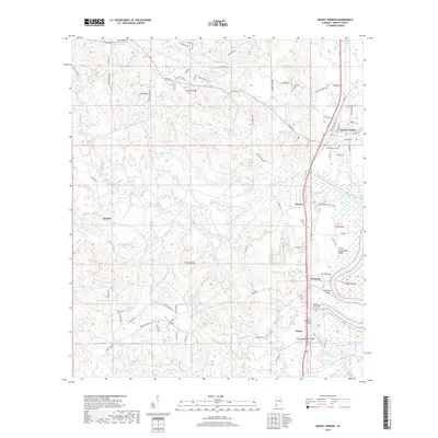
2018 Map of Mount Vernon
USGS Topo · Published 2018About this map
The Mobile River corridor north of Mobile is defined by a succession of river bluffs and small rail-aligned settlements in this 2018 survey. Mount Vernon serves as the primary hub, surrounded by family-named landmarks and historical sites like Mount Vernon Cem and Byrd Cem. The landscape transitions from the river's eastern bottomlands to the elevated ridges of the west, where timber and local roads like Old US Hwy 43 connect smaller communities including Movico, Pineola, and Chastang. Along the riverbank, a series of numbered landings such as Thirty Seven Mile Bluff and Thirty One Mile Bluff indicate the historical importance of river navigation and mileage markers from the coast. Tributaries like Cedar Creek and Bull Br carve through the terrain, supporting several smaller cemeteries including Roper Cem and Seymour Bluff Cem, which provide significant points of interest for genealogists tracing local family histories in this part of Mobile County.
Find a feature on this map
83 named features on this map. Tap any name to fly to it.
Don’t see what you’re looking for? This feature index may not catch every label — zoom into the map to look around manually.
Map Details
Editions of this 2018 Mount Vernon Map
This is the sole edition of this map. No revisions or reprints were ever made.
Other maps of this area

1941 · Bay Minette
USGS Topo · 1:62,500

1941 · Creola
USGS Topo · 1:62,500

1943 · Creola
USGS Topo · 1:62,500

1943 · Bay Minette
USGS Topo · 1:62,500

1943 · Tensaw
USGS Topo · 1:62,500

1943 · Citronelle
USGS Topo · 1:62,500

1944 · Tensaw
USGS Topo · 1:62,500

1946 · Citronelle
USGS Topo · 1:62,500

1953 · Andalusia
USGS Topo · 1:250,000

1953 · Hattiesburg
USGS Topo · 1:250,000