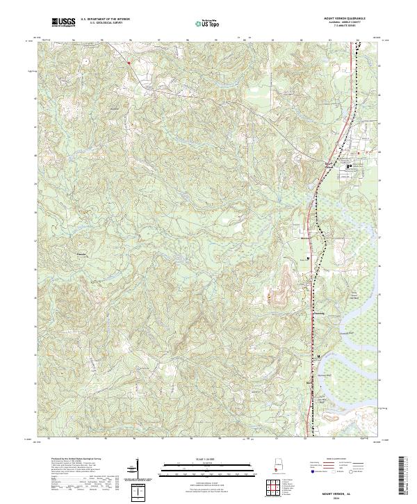
2024 Map of Mount Vernon
USGS Topo · Published 2024About this map
Mount Vernon serves as the central hub of this Mobile County landscape, where the town's residential grid meets the western bank of the Mobile River. The river's influence is evident in the series of named bluffs marking its course, including Thirty Seven Mile Bluff, Seymour Bluff, and Thirty One Mile Bluff. These high points historically provided crucial navigation markers and settlement sites safe from the floodplain. Inland, the terrain is defined by a dense network of tributaries such as Indian Grave Creek, Cedar Creek, and Bush Coon Creek, which feed toward the river valley.
Find a feature on this map
87 named features on this map. Tap any name to fly to it.
Don’t see what you’re looking for? This feature index may not catch every label — zoom into the map to look around manually.
Map Details
Editions of this 2024 Mount Vernon Map
This is the sole edition of this map. No revisions or reprints were ever made.
Other maps of this area

1941 · Bay Minette
USGS Topo · 1:62,500

1941 · Creola
USGS Topo · 1:62,500

1943 · Creola
USGS Topo · 1:62,500

1943 · Bay Minette
USGS Topo · 1:62,500

1943 · Tensaw
USGS Topo · 1:62,500

1943 · Citronelle
USGS Topo · 1:62,500

1944 · Tensaw
USGS Topo · 1:62,500

1946 · Citronelle
USGS Topo · 1:62,500

1953 · Andalusia
USGS Topo · 1:250,000

1953 · Hattiesburg
USGS Topo · 1:250,000