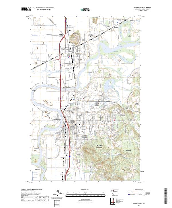
2023 Map of Mount Vernon
USGS Topo · Published 2023About this map
The Skagit River dominates this landscape, winding between the growing urban centers of Mount Vernon and Burlington. The river’s complex hydrology is visible through features like Gages Slough and the South Fork Skagit River, which define the low-lying valley floor. To the north, Burlington Hill and Sterling Hill rise above the alluvial plains, providing natural landmarks that have historically guided settlement away from the flood-prone margins of the Olympia Marsh.
Find a feature on this map
95 named features on this map. Tap any name to fly to it.
Don’t see what you’re looking for? This feature index may not catch every label — zoom into the map to look around manually.
Map Details
Editions of this 2023 Mount Vernon Map
This is the sole edition of this map. No revisions or reprints were ever made.
Other maps of this area

1911 · Mount Vernon
USGS Topo · 1:125,000

1918 · Samish Lake
USGS Topo · 1:62,500

1921 · Wickersham
USGS Topo · 1:62,500

1940 · Mt Vernon
USGS Topo · 1:62,500

1943 · Mt Vernon
USGS Topo · 1:62,500

1944 · Clear Lake
USGS Topo · 1:62,500

1951 · Wickersham
USGS Topo · 1:62,500

1952 · Alger
USGS Topo · 1:24,000

1954 · Bow
USGS Topo · 1:24,000

1954 · Samish Lake
USGS Topo · 1:62,500