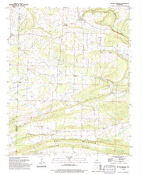
1994 Map of Mount Vernon
USGS Topo · Published 1994About this map
The settlement of Mount Vernon anchor the western edge of this central Arkansas survey, where the landscape is defined by the winding course of Muddy Bayou and the prominent rising of Tucker Bluff. This mid-1990s record of the border between Faulkner Co and White Co captures a rural community structured around family cemeteries and country churches. Local landmarks such as Hammons Chapel Cem and Smyrna Ch serve as touchstones for genealogical research, while the terrain transitions into the distinct ridges of Bull Mountain and Cadron Ridge to the south. Small tributaries like Little Bull Creek and Turkey Branch carve through the hills, providing a detailed look at the drainage patterns near Romance and El Paso before the intensification of modern development. The presence of a significant Pipeline corridor crossing the northern half of the map indicates the mid-century infrastructure that integrated this agricultural region into a broader industrial network.
Find a feature on this map
30 named features on this map. Tap any name to fly to it.
Don’t see what you’re looking for? This feature index may not catch every label — zoom into the map to look around manually.
Map Details
Editions of this 1994 Mount Vernon Map
This is the sole edition of this map. No revisions or reprints were ever made.
Other maps of this area

1953 · Memphis
USGS Topo · 1:250,000

1956 · Memphis
USGS Topo · 1:250,000

1956 · Russellville
USGS Topo · 1:250,000

1963 · Rose Bud
USGS Topo · 1:24,000

1963 · Floyd
USGS Topo · 1:24,000

1963 · Enola
USGS Topo · 1:24,000

1963 · Mount Vernon
USGS Topo · 1:24,000

1963 · Sidon
USGS Topo · 1:24,000
1963 · Beebe
USGS Topo · 1:24,000
1963 · Mountain Springs
USGS Topo · 1:24,000