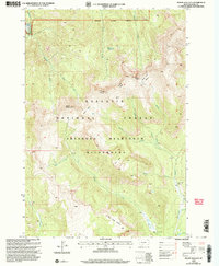
2000 Map of Mount Wallace
USGS Topo · Published 2005About this map
Mount Wallace towers over this section of the Absaroka Beartooth Wilderness, a landscape defined by sharp drainage basins and high plateaus. The topography is intricately detailed, showing the convergence of Clover Creek and Wallace Creek as they cut through the Gallatin National Forest. The map captures the remote character of southern Montana before the turn of the 21st century, where the only sign of habitation is the isolated Bull Moose Cabin near the eastern boundary.
Find a feature on this map
26 named features on this map. Tap any name to fly to it.
Don’t see what you’re looking for? This feature index may not catch every label — zoom into the map to look around manually.
Map Details
Editions of this 2000 Mount Wallace Map
This is the sole edition of this map. No revisions or reprints were ever made.
Other maps of this area

1891 · Livingston
USGS Topo · 1:250,000

1893 · Livingston
USGS Topo · 1:250,000

1940 · Mt. Cowen
USGS Topo · 1:62,500

1940 · Mt Wallace
USGS Topo · 1:62,500

1943 · Mt Wallace
USGS Topo · 1:62,500

1943 · Mt Cowen
USGS Topo · 1:62,500

1947 · Bozeman
USGS Topo · 1:250,000

1948 · Bozeman
USGS Topo · 1:250,000

1955 · Bozeman
USGS Topo · 1:250,000

1955 · Emigrant
USGS Topo · 1:62,500