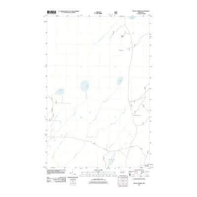
2011 Map of Mount Weber
USGS Topo · Published 2011About this map
Mount Weber stands as a prominent high point in this lake-strewn portion of northeastern Minnesota. The landscape is defined by its glacial hydrology, with drainage patterns weaving through numerous small water bodies including Alseth Lake, Upland Lake, and Crest Lake. In the southern portion of the quadrangle, Sullivan Lake and Sullivan Creek feed into the Cloquet River near the small settlement of Jordan.
Find a feature on this map
20 named features on this map. Tap any name to fly to it.
Don’t see what you’re looking for? This feature index may not catch every label — zoom into the map to look around manually.
Map Details
Editions of this 2011 Mount Weber Map
This is the sole edition of this map. No revisions or reprints were ever made.
Other maps of this area
1952 · Babbitt SE
USGS Topo · 1:24,000
1953 · Whyte
USGS Topo · 1:62,500
1954 · Greenwood Lake
USGS Topo · 1:62,500
1954 · Two Harbors
USGS Topo · 1:250,000
1957 · Two Harbors
USGS Topo · 1:250,000
1957 · Brimson
USGS Topo · 1:62,500
1958 · Two Harbors
USGS Topo · 1:250,000
1964 · Two Harbors
USGS Topo · 1:250,000
1976 · Two Harbors
USGS Topo · 1:100,000
1981 · Legler Lake
USGS Topo · 1:24,000