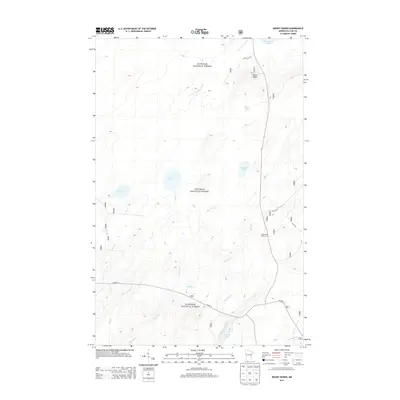
2013 Map of Mount Weber
USGS Topo · Published 2013About this map
Mount Weber rises as a prominent landmark within the expansive Superior National Forest in Lake County. This 2013 topographic study documents a landscape defined by an intricate network of glacial lakes and creeks that feed the headwaters of the Cloquet River. Large water bodies such as Greenwood Lake and Sullivan Lake are connected by numerous smaller drainages including Murphy Cr, Little Mud Cr, and S Greenwood Cr. Human presence in this northern wilderness is centered around forest management and recreation, evidenced by Forest Rte 813, Whyte Rd, and the White Pine Picnic Area. The map reveals the characteristic drainage patterns of the Arrowhead Region, where subtle elevation changes guide water through a series of named basins like Crest Lake and Hjalmer Lake.
Find a feature on this map
21 named features on this map. Tap any name to fly to it.
Don’t see what you’re looking for? This feature index may not catch every label — zoom into the map to look around manually.
Map Details
Editions of this 2013 Mount Weber Map
This is the sole edition of this map. No revisions or reprints were ever made.
Other maps of this area

1952 · Babbitt SE
USGS Topo · 1:24,000

1953 · Whyte
USGS Topo · 1:62,500

1954 · Greenwood Lake
USGS Topo · 1:62,500

1954 · Two Harbors
USGS Topo · 1:250,000

1957 · Two Harbors
USGS Topo · 1:250,000

1957 · Brimson
USGS Topo · 1:62,500

1958 · Two Harbors
USGS Topo · 1:250,000

1964 · Two Harbors
USGS Topo · 1:250,000

1976 · Two Harbors
USGS Topo · 1:100,000
1981 · Legler Lake
USGS Topo · 1:24,000