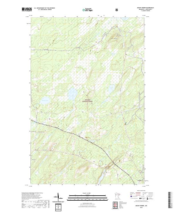
2022 Map of Mount Weber
USGS Topo · Published 2022About this map
Mt Weber rises above a dense network of glacial lakes and wetlands within the Superior National Forest. This landscape is defined by its water, from the sprawling Greenwood Lake in the northeast to smaller basins like Alseth Lake, Upland Lake, and Crest Lake. The map reveals a specialized transportation network adapted for the north woods, including the Stoney River Grade Yukon and various forest roads like Toimi Road and Nelson Road. The small settlement of Jordan appears in the southeast corner near Sullivan Lake, representing a rare pocket of concentrated human activity in this heavily forested region. Numerous drainages such as Greenwood Creek and Sullivan Creek connect these basins, illustrating the complex hydrology of the Lake County interior before these waters reach the larger regional river systems.
Find a feature on this map
38 named features on this map. Tap any name to fly to it.
Don’t see what you’re looking for? This feature index may not catch every label — zoom into the map to look around manually.
Map Details
Editions of this 2022 Mount Weber Map
This is the sole edition of this map. No revisions or reprints were ever made.
Other maps of this area

1952 · Babbitt SE
USGS Topo · 1:24,000

1953 · Whyte
USGS Topo · 1:62,500

1954 · Greenwood Lake
USGS Topo · 1:62,500

1954 · Two Harbors
USGS Topo · 1:250,000

1957 · Two Harbors
USGS Topo · 1:250,000

1957 · Brimson
USGS Topo · 1:62,500

1958 · Two Harbors
USGS Topo · 1:250,000

1964 · Two Harbors
USGS Topo · 1:250,000

1976 · Two Harbors
USGS Topo · 1:100,000
1981 · Legler Lake
USGS Topo · 1:24,000