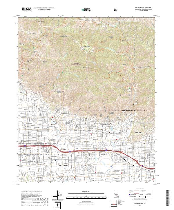
2022 Map of Mount Wilson
USGS Topo · Published 2022About this map
The San Gabriel Mountains tower over the northern sprawl of the Los Angeles basin in this detailed survey, showing the sharp transition between dense residential development and the steep, trail-laced slopes of the Angeles National Forest. Within the urban corridor, the map records the academic grounds of the California Institute of Technology and Pasadena City College, while the neighborhood of Lamanda Park and the distinct community of Kinneloa Mesa sit at the edge of the climbing terrain.
Find a feature on this map
128 named features on this map. Tap any name to fly to it.
Don’t see what you’re looking for? This feature index may not catch every label — zoom into the map to look around manually.
Map Details
Editions of this 2022 Mount Wilson Map
This is the sole edition of this map. No revisions or reprints were ever made.
Other maps of this area

1894 · Los Angeles
USGS Topo · 1:62,500

1894 · Pomona
USGS Topo · 1:62,500

1896 · Pasadena
USGS Topo · 1:62,500

1897 · Pomona
USGS Topo · 1:62,500

1898 · Pomona
USGS Topo · 1:62,500

1900 · Pasadena
USGS Topo · 1:62,500

1900 · Tujunga
USGS Topo · 1:62,500

1900 · Los Angeles
USGS Topo · 1:62,500

1901 · Southern California Sheet No. 1
USGS Topo · 1:250,000

1903 · Rock Creek
USGS Topo · 1:62,500