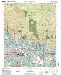
1995 Map of Mount Wilson
USGS Topo · Published 1999About this map
Mount Wilson serves as the focal point of this survey, where the Observatory, Michelson Museum, and Solar Camera Tower mark a landscape dedicated to scientific advancement. This high-elevation cluster contrasts with the suburban development unfolding at the base of the mountains, where the California Institute of Technology and the Huntington Library anchor the academic and cultural identity of the region. The map preserves the complex interface between the organized streets of Altadena, Pasadena, and Monrovia and the protected lands of the Angeles National Forest.
Find a feature on this map
97 named features on this map. Tap any name to fly to it.
Don’t see what you’re looking for? This feature index may not catch every label — zoom into the map to look around manually.
Map Details
Editions of this 1995 Mount Wilson Map
This is the sole edition of this map. No revisions or reprints were ever made.
Other maps of this area

1894 · Los Angeles
USGS Topo · 1:62,500

1894 · Pomona
USGS Topo · 1:62,500

1896 · Pasadena
USGS Topo · 1:62,500

1897 · Pomona
USGS Topo · 1:62,500

1898 · Pomona
USGS Topo · 1:62,500

1900 · Pasadena
USGS Topo · 1:62,500

1900 · Tujunga
USGS Topo · 1:62,500

1900 · Los Angeles
USGS Topo · 1:62,500

1901 · Southern California Sheet No. 1
USGS Topo · 1:250,000

1903 · Rock Creek
USGS Topo · 1:62,500