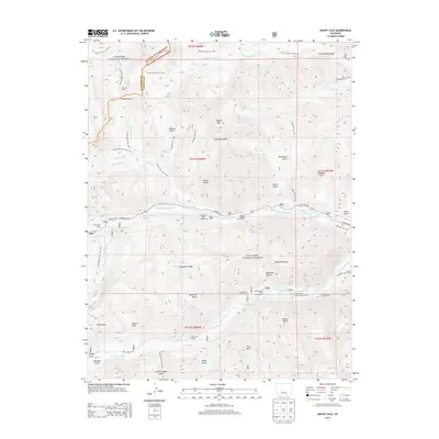
2013 Map of Mount Yale
USGS Topo · Published 2013About this map
Mount Yale dominates this high-altitude landscape along the boundary of Gunnison National Forest and San Isabel National Forest. This 2013 survey documents a network of footpaths and alpine features, including the Colorado Trail and the ascent paths of the Collegiate Peaks. Traces of earlier mountain habitation are preserved at Browns Cabin and Hangmans Cabin, situated near the headwaters of Texas Creek and Middle Cottonwood Creek. The drainage patterns of the Sawatch Range are intricately detailed, showing the flow from high basins like Avalanche Gulch and Delaney Gulch into Cottonwood Lake and Rainbow Lake. Developed recreational sites such as Collegiate Peaks Campground and the Cottonwood Lake Picnic Ground indicate the area's transition from early pioneer routes to a managed wilderness for hiking and fishing.
Find a feature on this map
63 named features on this map. Tap any name to fly to it.
Don’t see what you’re looking for? This feature index may not catch every label — zoom into the map to look around manually.
Map Details
Editions of this 2013 Mount Yale Map
This is the sole edition of this map. No revisions or reprints were ever made.
Other maps of this area

1940 · Garfield
USGS Topo · 1:62,500

1945 · Garfield
USGS Topo · 1:62,500

1955 · Buena Vista
USGS Topo · 1:62,500

1955 · Mount Harvard
USGS Topo · 1:62,500

1956 · Poncha Springs
USGS Topo · 1:62,500

1956 · Montrose
USGS Topo · 1:250,000

1959 · Montrose
USGS Topo · 1:250,000

1960 · Montrose
USGS Topo · 1:250,000

1968 · Montrose
USGS Topo · 1:250,000

1982 · Buena Vista West
USGS Topo · 1:24,000