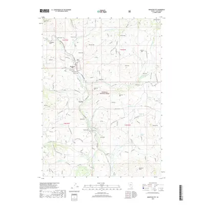
2018 Map of Mountain City
USGS Topo · Published 2018About this map
Mountain City and Patsville serve as the primary human centers in this high-desert landscape of northern Elko County, positioned along the winding Owyhee River. The map reveals a region deeply shaped by mining and grazing, with several prospect sites including Gem 1 and Golden 3 located north of the main settlements. The terrain is marked by distinct geological formations such as the Bruneau Range and the Wild Horse Range, which provide a dramatic backdrop to the dispersed network of forest roads and trails like Mountain City Drive and the Mt. City ATV routes. Much of the land is managed as part of the Humboldt National Forest, where features like Devils Gate and Quartzite Hill dominate the topography. Local history is etched into the landscape through family-named landmarks such as Hansen Gulch, Russel Gulch, and Ross Gulch, while several springs, including Roach Spring and Muddy Flat Spring, suggest the critical importance of water in this arid environment.
Find a feature on this map
107 named features on this map. Tap any name to fly to it.
Don’t see what you’re looking for? This feature index may not catch every label — zoom into the map to look around manually.
Map Details
Editions of this 2018 Mountain City Map
This is the sole edition of this map. No revisions or reprints were ever made.
Other maps of this area

1936 · Mountain City
USGS Topo · 1:62,500

1939 · Owyhee
USGS Topo · 1:62,500

1940 · Mountain City
USGS Topo · 1:62,500

1942 · Owyhee
USGS Topo · 1:62,500

1955 · McDermitt
USGS Topo · 1:250,000

1955 · Wells
USGS Topo · 1:250,000

1956 · Bull Run
USGS Topo · 1:62,500

1956 · Wild Horse
USGS Topo · 1:62,500

1958 · Wells
USGS Topo · 1:250,000

1959 · McDermitt
USGS Topo · 1:250,000