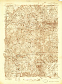
1936 Map of Mountain City
USGS Topo · Published 1936About this map
Mountain City and the surrounding high country of Elko County are documented in this 1936 survey, which reveals a landscape defined by ranching and mineral exploration. The mining activity of the era is prominent, with sites like the McDonald Mine, Silver Banner Mine, and Golden Ensign Mine dotting the ridges. The presence of the Mountain City Landing Field and the Mountain City Ranger Station underscores the town's role as a regional hub within the Humboldt National Forest.
Find a feature on this map
63 named features on this map. Tap any name to fly to it.
Don’t see what you’re looking for? This feature index may not catch every label — zoom into the map to look around manually.
Map Details
Editions of this 1936 Mountain City Map
4 editions found
Other maps of this area

1935 · Charleston
USGS Topo · 1:48,000

1936 · Mountain City
USGS Topo · 1:62,500

1936 · Rowland
USGS Topo · 1:48,000

1939 · Owyhee
USGS Topo · 1:62,500

1940 · Rowland
USGS Topo · 1:62,500

1940 · Mountain City
USGS Topo · 1:62,500

1942 · Owyhee
USGS Topo · 1:62,500

1942 · Mt. Velma
USGS Topo · 1:62,500

1955 · McDermitt
USGS Topo · 1:250,000

1955 · Jordan Valley
USGS Topo · 1:250,000