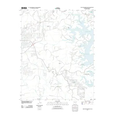
2011 Map of Mountain Home East
USGS Topo · Published 2011About this map
Norfork Lake dominates the eastern landscape of this Baxter County region, its winding shoreline creating numerous points and landings such as Buzzard Roost Landing and Traceys Landing. The area reflects a transition from rural homesteads to modern lakeside developments, anchored by the settlement of Briarcliff in the southeast. A network of county roads, including County Rd-289 and County Rd-537, connects the upland ridges with the deep drainages of Panther Creek, Fall Creek, and Big Creek.
Find a feature on this map
149 named features on this map. Tap any name to fly to it.
Don’t see what you’re looking for? This feature index may not catch every label — zoom into the map to look around manually.
Map Details
Editions of this 2011 Mountain Home East Map
This is the sole edition of this map. No revisions or reprints were ever made.
Other maps of this area

1890 · Mountain Home
USGS Topo · 1:125,000

1891 · Mountain Home
USGS Topo · 1:125,000

1894 · Mountain Home
USGS Topo · 1:125,000

1945 · Harrison
USGS Topo · 1:250,000

1949 · Harrison
USGS Topo · 1:250,000

1954 · Harrison
USGS Topo · 1:250,000

1958 · Harrison
USGS Topo · 1:250,000

1964 · Harrison
USGS Topo · 1:250,000
1964 · Norfork Dam South
USGS Topo · 1:24,000
1965 · Clarkridge
USGS Topo · 1:24,000