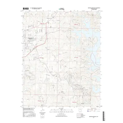
2017 Map of Mountain Home East
USGS Topo · Published 2017About this map
Mountain Home serves as the regional hub in this 2017 survey, where suburban expansion meets the varied topography of Baxter County. The landscape is defined by the significant presence of Norfork Lake to the east and the high points of Heart Bald and Birdsong Mtn further south. This edition reveals a mix of established community centers and rural homesteads, with the residential pockets of Briarcliff and Salesville situated among a network of creeks like Panther Fork and Vickory Cr.
Find a feature on this map
174 named features on this map. Tap any name to fly to it.
Don’t see what you’re looking for? This feature index may not catch every label — zoom into the map to look around manually.
Map Details
Editions of this 2017 Mountain Home East Map
This is the sole edition of this map. No revisions or reprints were ever made.
Other maps of this area

1890 · Mountain Home
USGS Topo · 1:125,000

1891 · Mountain Home
USGS Topo · 1:125,000

1894 · Mountain Home
USGS Topo · 1:125,000

1945 · Harrison
USGS Topo · 1:250,000

1949 · Harrison
USGS Topo · 1:250,000

1954 · Harrison
USGS Topo · 1:250,000

1958 · Harrison
USGS Topo · 1:250,000

1964 · Harrison
USGS Topo · 1:250,000
1964 · Norfork Dam South
USGS Topo · 1:24,000
1965 · Clarkridge
USGS Topo · 1:24,000