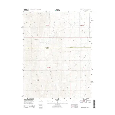
2014 Map of Mountain Home Pass
USGS Topo · Published 2014About this map
Mountain Home Pass serves as the central focal point of this arid Great Basin landscape, where the Mountain Home Range transitions across the border of Millard and Beaver counties. The hydrology of this high-desert region is defined by a series of isolated water sources, including Mountain Home Spring, Sand Spring, and Cobb Spring. The presence of these named water points, alongside others like Tub Spring and Cherry Spring, suggests their vital importance for livestock and travel through the passes. In the southeastern portion of the quadrangle, the terrain becomes increasingly complex near The Needles and McCune Pass, while Antelope Valley opens up to the northeast. This 2014 survey documents a rugged, unpopulated expanse where the grid of the Public Land Survey System provides the primary structure for navigating the vast open country.
Find a feature on this map
19 named features on this map. Tap any name to fly to it.
Don’t see what you’re looking for? This feature index may not catch every label — zoom into the map to look around manually.
Map Details
Editions of this 2014 Mountain Home Pass Map
This is the sole edition of this map. No revisions or reprints were ever made.
Other maps of this area

1953 · Richfield
USGS Topo · 1:250,000

1956 · Lund
USGS Topo · 1:250,000

1958 · Richfield
USGS Topo · 1:250,000

1960 · Lund
USGS Topo · 1:250,000

1971 · Mountain Home Pass
USGS Topo · 1:24,000

1971 · Halfway Summit
USGS Topo · 1:24,000

1971 · Tunnel Spring
USGS Topo · 1:24,000

1971 · Sawtooth Peak
USGS Topo · 1:24,000

1971 · Mormon Gap
USGS Topo · 1:24,000

1972 · Hamlin Well
USGS Topo · 1:24,000