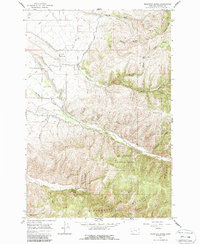
1964 Map of Mountain House
USGS Topo · Published 1987About this map
Bitterroot National Forest dominates the southern half of this map, where the terrain transitions from the developed valley floor to steep, gulch-carved mountains. The lower elevations near Hamilton Airport and the Hamilton Golf Course reveal a sophisticated water management system designed to support agriculture in the high desert of Ravalli County. Large-scale infrastructure like the Bitterroot Irrigation District Canal, Ward Ditch, and Hedge Ditch cut across the landscape, while the Skalkaho High Line Ditch and Skalkaho Aqueduct navigate the more difficult terrain to the east. These canals and aqueducts represent the vital lifelines of the local ranching and farming economy during the mid-1960s.
Find a feature on this map
35 named features on this map. Tap any name to fly to it.
Don’t see what you’re looking for? This feature index may not catch every label — zoom into the map to look around manually.
Map Details
Editions of this 1964 Mountain House Map
2 editions found
Other maps of this area

1901 · Hamilton
USGS Topo · 1:125,000

1909 · Sapphire
USGS Topo · 1:125,000

1947 · Butte
USGS Topo · 1:250,000

1956 · Hamilton
USGS Topo · 1:250,000

1958 · Butte
USGS Topo · 1:250,000

1959 · Hamilton
USGS Topo · 1:250,000

1960 · Butte
USGS Topo · 1:250,000

1960 · Hamilton
USGS Topo · 1:250,000

1962 · Butte
USGS Topo · 1:250,000

1964 · Hamilton
USGS Topo · 1:250,000