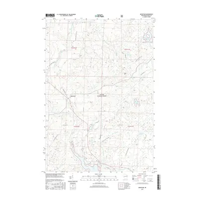
2015 Map of Mountain
USGS Topo · Published 2015About this map
The community of Mountain serves as the focal point of this northern Wisconsin landscape, situated along the winding North Branch Oconto River and within the protected boundaries of the Nicolet National Forest. The topography is defined by its extensive water network, ranging from the prominent Chute Pond and Waupee Flowage to smaller bodies like Bear Paw Lake, Sunrise Lake, and Midget Lake. These waters reflect a landscape managed for both timber and recreation, connected by a dense system of forest roads such as National Forest Road 2310 and National Forest Road 2297.
Find a feature on this map
48 named features on this map. Tap any name to fly to it.
Don’t see what you’re looking for? This feature index may not catch every label — zoom into the map to look around manually.
Map Details
Editions of this 2015 Mountain Map
This is the sole edition of this map. No revisions or reprints were ever made.
Other maps of this area

1940 · Thunder Mtn.
USGS Topo · 1:48,000

1942 · Breed
USGS Topo · 1:48,000

1942 · Wabeno
USGS Topo · 1:48,000

1950 · Wabeno
USGS Topo · 1:48,000

1951 · Wabeno
USGS Topo · 1:48,000

1951 · Thunder Mountain
USGS Topo · 1:48,000

1952 · Langlade
USGS Topo · 1:48,000

1952 · Mountain
USGS Topo · 1:48,000

1954 · Iron Mountain
USGS Topo · 1:250,000

1959 · Iron Mountain
USGS Topo · 1:250,000