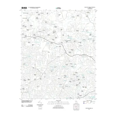
2011 Map of Mountain Park
USGS Topo · Published 2011About this map
Arnold Mill and the banks of the Little River anchor this 2011 survey of the northern reaches of the Atlanta suburbs. The landscape is a dense network of suburban residential developments and private lakes, each managed by numerous water control structures such as the Tharp Lake Dam and Fulton Dam. Local history is preserved in several small family and community burial grounds, including the Mabry Cemetery, Kemp Cemetery, and Hardman Cemetery. Higher elevations like Sweat Mountain provide prominent landmarks, home to the Sweat Mountain Lookout Tower. The transition from rural roots to contemporary residential patterns is evident in the survival of names like Hunters Mill and Nowlin Hall alongside modern neighborhoods and recreation sites such as the Brookfield West Golf Course. Small-scale aviation is represented by Air Acres Airport, situated near the winding course of the river.
Find a feature on this map
158 named features on this map. Tap any name to fly to it.
Don’t see what you’re looking for? This feature index may not catch every label — zoom into the map to look around manually.
Map Details
Editions of this 2011 Mountain Park Map
This is the sole edition of this map. No revisions or reprints were ever made.
Other maps of this area

1888 · Atlanta
USGS Topo · 1:125,000

1890 · Suwanee
USGS Topo · 1:125,000

1890 · Cartersville
USGS Topo · 1:125,000

1890 · Atlanta
USGS Topo · 1:125,000

1891 · Marietta
USGS Topo · 1:125,000

1891 · Cartersville
USGS Topo · 1:125,000

1892 · Atlanta
USGS Topo · 1:125,000

1894 · Suwanee
USGS Topo · 1:125,000

1895 · Atlanta
USGS Topo · 1:125,000

1895 · Marietta
USGS Topo · 1:125,000