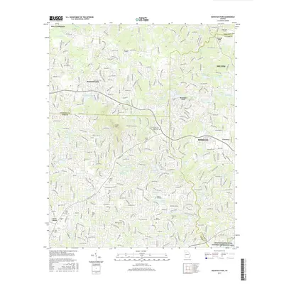
2017 Map of Mountain Park
USGS Topo · Published 2017About this map
Mountain Park and the burgeoning suburban landscapes of Roswell and Woodstock dominate this modern topographical record. The terrain is defined by the high ground of Sweat Mountain and the winding course of the Little River, which feeds into numerous reservoirs such as Gordy Lake and Cochrans Lake North. This map is particularly valuable for genealogists, as it meticulously preserves the locations of several community burial grounds, including the Holly Springs Baptist Cemetery, Wesley Chapel Cemetery, and the Mount Beulah Cemetery. Transportation patterns are evidenced by local airfields like Air Acres Airport and Holly Farm Airport, reflecting the region's mid-to-late 20th-century development. The convergence of three counties—Cherokee, Cobb, and Fulton—creates a complex jurisdictional boundary area that has shaped the growth of settlements like Arnold Mill and Milton.
Find a feature on this map
326 named features on this map. Tap any name to fly to it.
Don’t see what you’re looking for? This feature index may not catch every label — zoom into the map to look around manually.
Map Details
Editions of this 2017 Mountain Park Map
This is the sole edition of this map. No revisions or reprints were ever made.
Other maps of this area

1888 · Atlanta
USGS Topo · 1:125,000

1890 · Suwanee
USGS Topo · 1:125,000

1890 · Cartersville
USGS Topo · 1:125,000

1890 · Atlanta
USGS Topo · 1:125,000

1891 · Marietta
USGS Topo · 1:125,000

1891 · Cartersville
USGS Topo · 1:125,000

1892 · Atlanta
USGS Topo · 1:125,000

1894 · Suwanee
USGS Topo · 1:125,000

1895 · Atlanta
USGS Topo · 1:125,000

1895 · Marietta
USGS Topo · 1:125,000