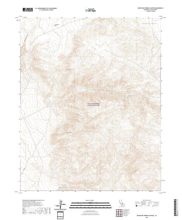
2021 Map of Mountain Springs Canyon
USGS Topo · Published 2021About this map
Mountain Spring provides a vital water source in this high desert landscape, located where the Argus Range meets the northern reaches of the Mojave Desert. This 2021 survey illustrates the dramatic elevation changes characteristic of the Inyo County interior, featuring prominent landforms such as Wild Horse Mesa and the deeply incised Mountain Springs Canyon. The topography is defined by these steep canyons and broad mesas, with Renegade Canyon and Wilson Canyon cutting through the arid terrain. Human passage through this environment is primarily represented by Darwin Rd, which traverses the southwestern portion of the map. This modern digital survey by the U.S. Geological Survey emphasizes the natural hydrography and elevation data of the Etcharren Valley and its surrounding peaks, serving as a clear record of this unpopulated but geographically complex region of California.
Find a feature on this map
15 named features on this map. Tap any name to fly to it.
Don’t see what you’re looking for? This feature index may not catch every label — zoom into the map to look around manually.
Map Details
Editions of this 2021 Mountain Springs Canyon Map
This is the sole edition of this map. No revisions or reprints were ever made.
Other maps of this area

1908 · Ballarat
USGS Topo · 1:250,000

1913 · Ballarat
USGS Topo · 1:250,000

1915 · Searles Lake
USGS Topo · 1:250,000

1947 · Trona
USGS Topo · 1:250,000

1948 · Trona
USGS Topo · 1:250,000

1948 · Death Valley
USGS Topo · 1:250,000

1949 · Trona
USGS Topo · 1:62,500

1950 · Trona
USGS Topo · 1:62,500

1951 · Maturango Peak
USGS Topo · 1:62,500

1951 · Coso Peak
USGS Topo · 1:62,500