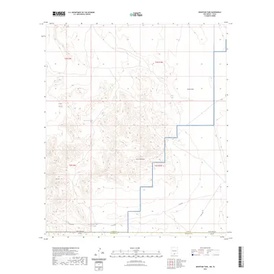
2023 Map of Mountain Tank
USGS Topo · Published 2023About this map
Fort Bliss dominates the western portion of this high-desert landscape, where the rugged terrain of the Hueco Mountains meets the vast military reservation near the New Mexico-Texas state line. The map reveals a specialized arid-land water infrastructure, essential for both livestock and military operations, marked by features such as Grey Tank, Red House Tanks, and Wallbridge Tank. These catchments are critical landmarks in a region defined by dramatic elevation changes, from the heights of Red Hill to the drainage of Castner Draw. Modern ranching and military access are represented by local routes including Co Rd F001 and Co Rd F002, which cross the boundaries of Otero and Hudspeth counties. The placement of these water sources and tracks illustrates the ongoing human adaptation to the Chihuahuan Desert environment.
Find a feature on this map
17 named features on this map. Tap any name to fly to it.
Don’t see what you’re looking for? This feature index may not catch every label — zoom into the map to look around manually.
Map Details
Editions of this 2023 Mountain Tank Map
This is the sole edition of this map. No revisions or reprints were ever made.
Other maps of this area

1896 · El Paso
USGS Topo · 1:125,000

1903 · Cerro Alto
USGS Topo · 1:125,000

1908 · El Paso
USGS Topo · 1:125,000

1939 · Heuco Tanks
USGS Topo · 1:62,500

1940 · Heuco Tanks
USGS Topo · 1:62,500

1940 · Bassett Lake
USGS Topo · 1:62,500

1941 · Heuco Mountains
USGS Topo · 1:62,500

1941 · Desert
USGS Topo · 1:62,500

1943 · Desert
USGS Topo · 1:62,500

1943 · Heuco Mountains
USGS Topo · 1:62,500