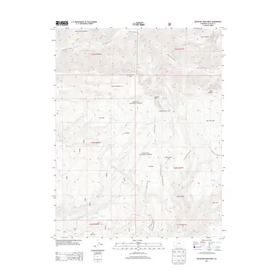
2013 Map of Mountain View Crest
USGS Topo · Published 2013About this map
San Juan National Forest defines this high-elevation landscape in La Plata County, where the Animas River and Florida River systems drain through a complex network of canyons and gulches. The terrain is dominated by the West Needle Mountains and the Needle Mountains, which rise above significant landforms such as Mountain View Crest and Tank Mesa. Access to this remote backcountry is documented via several established routes, including the Animas River Trail 675 and the Needle Creek Trail 504. High-altitude water bodies like Henderson Lake, Emerald Lake, and the Oliver Lakes are scattered throughout the region. The map also captures several distinct open areas such as Big Bear Park and Lower Park, as well as the named drainage of West Virginia Gulch.
Find a feature on this map
48 named features on this map. Tap any name to fly to it.
Don’t see what you’re looking for? This feature index may not catch every label — zoom into the map to look around manually.
Map Details
Editions of this 2013 Mountain View Crest Map
This is the sole edition of this map. No revisions or reprints were ever made.
Other maps of this area

1898 · Durango
USGS Topo · 1:62,500

1898 · Engineer Mountain
USGS Topo · 1:62,500

1900 · Engineer Mountain
USGS Topo · 1:62,500

1900 · Needle Mountains
USGS Topo · 1:62,500

1902 · Needle Mountains
USGS Topo · 1:62,500

1907 · Durango
USGS Topo · 1:62,500

1908 · Engineer Mountain
USGS Topo · 1:62,500

1908 · Ignacio
USGS Topo · 1:125,000

1908 · Durango
USGS Topo · 1:62,500

1924 · Ignacio
USGS Topo · 1:125,000