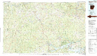
1983 Map of Mountain View
USGS Topo · Published 1983About this map
The Ozark National Forest and the Boston Mountains dominate this 1983 topographic study, revealing the complex drainage basins of north-central Arkansas. The landscape is defined by the winding course of the Buffalo National River in the north and the expansive Greers Ferry Lake to the southeast. Major road corridors including US Highway 65 and State Highway 9 connect established mountain communities like Marshall, Leslie, and Clinton.
Find a feature on this map
86 named features on this map. Tap any name to fly to it.
Don’t see what you’re looking for? This feature index may not catch every label — zoom into the map to look around manually.
Map Details
Editions of this 1983 Mountain View Map
This is the sole edition of this map. No revisions or reprints were ever made.
Other maps of this area

1879 · Washington
USGS Topo · 1:62,500

1887 · Smyrna
USGS Topo · 1:62,500

1888 · Dardanelle #1
USGS Topo · 1:62,500

1889 · Treat
USGS Topo · 1:62,500

1889 · Marshall #3
USGS Topo · 1:62,500

1890 · Batesville
USGS Topo · 1:125,000

1890 · Dardanelle
USGS Topo · 1:125,000

1890 · Mountain Home
USGS Topo · 1:125,000

1891 · Mountain Home
USGS Topo · 1:125,000

1891 · Batesville
USGS Topo · 1:125,000