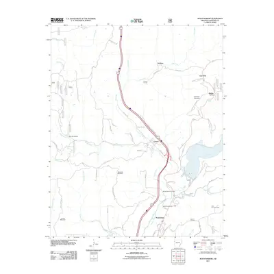
2011 Map of Mountainburg
USGS Topo · Published 2011About this map
Frog Bayou carves a deep path through Crawford County, defining the drainage patterns that shaped local settlements like Mountainburg and Chester. This 2011 topographic study illustrates how the valley floor remains a critical corridor for transportation and water management, anchored by the Lake Fort Smith Dam in the southeast. The landscape is marked by a series of prominent rises including Cartwright Mountain, Meadow Mountain, and Locust Mountain, which separate the various creek branches.
Find a feature on this map
66 named features on this map. Tap any name to fly to it.
Don’t see what you’re looking for? This feature index may not catch every label — zoom into the map to look around manually.
Map Details
Editions of this 2011 Mountainburg Map
This is the sole edition of this map. No revisions or reprints were ever made.
Other maps of this area

1898 · Winslow #4
USGS Topo · 1:62,500

1898 · Winslow #3
USGS Topo · 1:62,500

1898 · Winslow
USGS Topo · 1:125,000

1901 · Winslow
USGS Topo · 1:125,000

1946 · Fort Smith
USGS Topo · 1:250,000

1965 · Fort Smith
USGS Topo · 1:250,000

1967 · Fort Smith
USGS Topo · 1:250,000
1969 · Mountainburg SW
USGS Topo · 1:24,000
1969 · Fern
USGS Topo · 1:24,000
1969 · Rudy
USGS Topo · 1:24,000