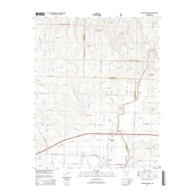
2014 Map of Mountainburg SE
USGS Topo · Published 2014About this map
Mulberry and the surrounding river valley anchor this 2014 survey, where the Mulberry River winds through the hills of Crawford and Franklin counties. The landscape is characterized by a high density of ancestral burial grounds, including the Ryles, Concord, and Quesenbury cemeteries, providing a detailed spatial record for genealogical research. Further north, the Ozark National Forest encompasses the rising elevations of Boney Mtn, while the community of Piney sits near the headwaters of Sycamore Cr. The settlement pattern follows the contours of the land, with Pleasant Hill and Dyer positioned along the southern transport corridor. Smaller waterways such as Little Mulberry Cr and Miller Br drain the timbered ridges, illustrating the complex hydrology of this part of the Arkansas Ozarks.
Find a feature on this map
96 named features on this map. Tap any name to fly to it.
Don’t see what you’re looking for? This feature index may not catch every label — zoom into the map to look around manually.
Map Details
Editions of this 2014 Mountainburg SE Map
This is the sole edition of this map. No revisions or reprints were ever made.
Other maps of this area

1879 · Cravens
USGS Topo · 1:62,500

1887 · Magazine Mountain #2
USGS Topo · 1:62,500

1887 · Watalula
USGS Topo · 1:62,500

1887 · Magazine Mountain
USGS Topo · 1:62,500

1890 · Magazine Mountain
USGS Topo · 1:125,000

1890 · Fort Smith
USGS Topo · 1:125,000

1898 · Winslow #4
USGS Topo · 1:62,500

1898 · Winslow
USGS Topo · 1:125,000

1901 · Winslow
USGS Topo · 1:125,000

1906 · Lavaca
USGS Topo · 1:62,500