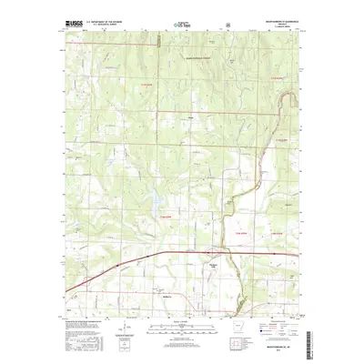
2017 Map of Mountainburg SE
USGS Topo · Published 2017About this map
Mulberry stands as the primary hub at the southern edge of this Crawford County landscape, where the Mulberry River winds toward the larger Ozark Lake system. The terrain transitions from the developed corridors near Pleasant Hill and Dyer into the protected elevations of the Ozark National Forest to the north. This 2017 survey reveals a deeply rooted rural community, evidenced by a high density of family and community cemeteries such as Concord Cem, Ryles Cem, and Dugan Cem scattered throughout the hills. Water management is a defining feature of the local geography, visible in the T J House Reservoir and several named mountain lakes like Brandenburg Lake and Bruce Lake. The map details a complex network of county roads and historic routes, including Old Wire Rd and N State Hwy 215, which navigate the rises of Boney Mtn and Boyd Mtn.
Find a feature on this map
98 named features on this map. Tap any name to fly to it.
Don’t see what you’re looking for? This feature index may not catch every label — zoom into the map to look around manually.
Map Details
Editions of this 2017 Mountainburg SE Map
This is the sole edition of this map. No revisions or reprints were ever made.
Other maps of this area

1879 · Cravens
USGS Topo · 1:62,500

1887 · Magazine Mountain #2
USGS Topo · 1:62,500

1887 · Watalula
USGS Topo · 1:62,500

1887 · Magazine Mountain
USGS Topo · 1:62,500

1890 · Magazine Mountain
USGS Topo · 1:125,000

1890 · Fort Smith
USGS Topo · 1:125,000

1898 · Winslow #4
USGS Topo · 1:62,500

1898 · Winslow
USGS Topo · 1:125,000

1901 · Winslow
USGS Topo · 1:125,000

1906 · Lavaca
USGS Topo · 1:62,500