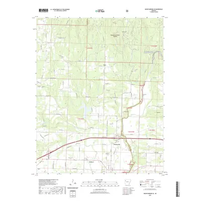
2020 Map of Mountainburg SE
USGS Topo · Published 2020About this map
Mulberry serves as the primary hub in this corner of Crawford County, situated along the southern edge of the Ozark National Forest. The landscape is defined by the transition from the forested heights of the Boston Mountains into the Arkansas River Valley, with the Mulberry Wild and Scenic River winding through the eastern portion. The settlement pattern reveals a series of small, potentially older communities like Piney and Pleasant Hill, often anchored by family-named landmarks and local burial grounds. Genealogists will find a high density of small cemeteries scattered across the terrain, including the Bratton, Chastain, and Dougan cemeteries, which often mark the location of early homesteads. The presence of Old Wire Rd and Old Graphic Rd highlights historical transportation corridors that predated modern highway systems, providing clues to the early development of this river-valley region.
Find a feature on this map
102 named features on this map. Tap any name to fly to it.
Don’t see what you’re looking for? This feature index may not catch every label — zoom into the map to look around manually.
Map Details
Editions of this 2020 Mountainburg SE Map
This is the sole edition of this map. No revisions or reprints were ever made.
Other maps of this area

1879 · Cravens
USGS Topo · 1:62,500

1887 · Magazine Mountain #2
USGS Topo · 1:62,500

1887 · Watalula
USGS Topo · 1:62,500

1887 · Magazine Mountain
USGS Topo · 1:62,500

1890 · Magazine Mountain
USGS Topo · 1:125,000

1890 · Fort Smith
USGS Topo · 1:125,000

1898 · Winslow #4
USGS Topo · 1:62,500

1898 · Winslow
USGS Topo · 1:125,000

1901 · Winslow
USGS Topo · 1:125,000

1906 · Lavaca
USGS Topo · 1:62,500