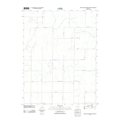
2012 Map of Mouth of Wild Horse Creek
USGS Topo · Published 2012About this map
The Saline River meanders across the northern portion of this Ellis County landscape, joined by its namesake tributary at the Wild Horse Cr confluence. This region is defined by its sectional grid of rural roads and the drainage patterns of the Tomcat Cr and E Spring Cr basins. The map illustrates a contemporary rural infrastructure where historical property lines are preserved through a network of thoroughfares like Saint John St Andrew Rd and Hixson Rd. The presence of Sleepy Hollow Rd and Homestead Rd suggests the enduring agricultural character of the high plains, while the varied terrain surrounding the river valley highlights the natural erosion patterns typical of the Kansas prairie. This survey offers a precise record of the land use and drainage systems in the early 21st century.
Find a feature on this map
20 named features on this map. Tap any name to fly to it.
Don’t see what you’re looking for? This feature index may not catch every label — zoom into the map to look around manually.
Map Details
Editions of this 2012 Mouth of Wild Horse Creek Map
This is the sole edition of this map. No revisions or reprints were ever made.
Other maps of this area

1893 · Ellis
USGS Topo · 1:125,000

1893 · Hill
USGS Topo · 1:125,000

1896 · Hays
USGS Topo · 1:125,000

1896 · Plainville
USGS Topo · 1:125,000

1955 · Great Bend
USGS Topo · 1:250,000

1955 · Beloit
USGS Topo · 1:250,000

1957 · Great Bend
USGS Topo · 1:250,000

1958 · Great Bend
USGS Topo · 1:250,000

1959 · Beloit
USGS Topo · 1:250,000

1961 · Yocemento
USGS Topo · 1:24,000