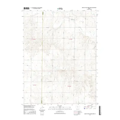
2016 Map of Mouth of Wild Horse Creek
USGS Topo · Published 2016About this map
The Saline River meanders across the northern portion of this landscape, carving a valley that defines the local topography in western Kansas. Near the namesake Mouth of Wild Horse Creek, the terrain transitions from river bottomlands to the dissected uplands of Ellis and Trego counties. A rigid grid of section-line roads, including Saline River Rd and Riverview Rd, provides access to this agricultural and ranching country. Cultural markers like the St John - St Andrew Rd suggest the enduring importance of local parish and community connections in this rural area. Water remains a primary feature of the environment, with intermittent drainage provided by Tomcat Cr and E Spring Cr alongside the prominent Wild Horse Creek. This survey illustrates the relationship between the natural hydrology of the plains and the orderly human geography of the High Plains.
Find a feature on this map
34 named features on this map. Tap any name to fly to it.
Don’t see what you’re looking for? This feature index may not catch every label — zoom into the map to look around manually.
Map Details
Editions of this 2016 Mouth of Wild Horse Creek Map
This is the sole edition of this map. No revisions or reprints were ever made.
Other maps of this area

1893 · Ellis
USGS Topo · 1:125,000

1893 · Hill
USGS Topo · 1:125,000

1896 · Hays
USGS Topo · 1:125,000

1896 · Plainville
USGS Topo · 1:125,000

1955 · Great Bend
USGS Topo · 1:250,000

1955 · Beloit
USGS Topo · 1:250,000

1957 · Great Bend
USGS Topo · 1:250,000

1958 · Great Bend
USGS Topo · 1:250,000

1959 · Beloit
USGS Topo · 1:250,000

1961 · Yocemento
USGS Topo · 1:24,000