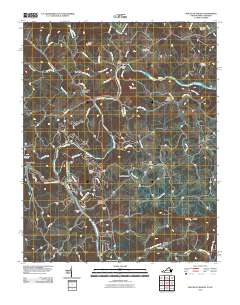
2010 Map of Mouth of Wilson
USGS Topo · Published 2010About this map
Mouth of Wilson serves as a focal point in this landscape where the Wilson Creek and the New River converge. The terrain is defined by the winding paths of the North Fork New River and South Fork New River, which carve through the high country past settlements like Jacks Bottom and Weavers Ford. This survey provides a precise look at the rural infrastructure of the early 21st century, documenting river crossings such as Kings Creek Ford and Anderson Ford, along with small-scale water management at Fields Dam and Stuart Dam.
Find a feature on this map
69 named features on this map. Tap any name to fly to it.
Don’t see what you’re looking for? This feature index may not catch every label — zoom into the map to look around manually.
Map Details
Editions of this 2010 Mouth of Wilson Map
This is the sole edition of this map. No revisions or reprints were ever made.
Other maps of this area

1889 · Wytheville
USGS Topo · 1:125,000

1889 · Wilkesboro
USGS Topo · 1:125,000

1891 · Wilkesboro
USGS Topo · 1:125,000

1892 · Wytheville
USGS Topo · 1:125,000

1930 · Independence
USGS Topo · 1:48,000

1933 · Independence
USGS Topo · 1:62,500

1935 · Mouth of Wilson
USGS Topo · 1:48,000
1935 · Trout Dale
USGS Topo · 1:24,000

1935 · Middle Fox Creek
USGS Topo · 1:24,000

1940 · Mouth of Wilson
USGS Topo · 1:62,500