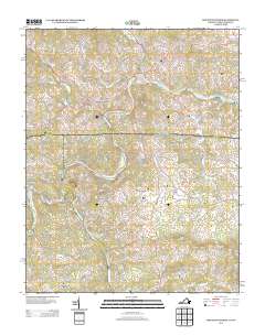
2013 Map of Mouth of Wilson
USGS Topo · Published 2013About this map
The New River snakes through the borderlands of North Carolina and Virginia, defining the complex topography of this 2013 survey. Near the junction of the N Fork New River and the S Fork New River, the landscape is dotted with small rural communities and river crossings like Kings Creek Ford and Weavers Ford. This area, encompassing Mouth of Wilson and Chestnut Hill, maintains a traditional settlement pattern where homes and farmsteads are connected by a network of winding roads like Troutdale Hwy and Jefferson Hwy.
Find a feature on this map
134 named features on this map. Tap any name to fly to it.
Don’t see what you’re looking for? This feature index may not catch every label — zoom into the map to look around manually.
Map Details
Editions of this 2013 Mouth of Wilson Map
This is the sole edition of this map. No revisions or reprints were ever made.
Other maps of this area

1889 · Wytheville
USGS Topo · 1:125,000

1889 · Wilkesboro
USGS Topo · 1:125,000

1891 · Wilkesboro
USGS Topo · 1:125,000

1892 · Wytheville
USGS Topo · 1:125,000

1930 · Independence
USGS Topo · 1:48,000

1933 · Independence
USGS Topo · 1:62,500

1935 · Mouth of Wilson
USGS Topo · 1:48,000
1935 · Trout Dale
USGS Topo · 1:24,000

1935 · Middle Fox Creek
USGS Topo · 1:24,000

1940 · Mouth of Wilson
USGS Topo · 1:62,500