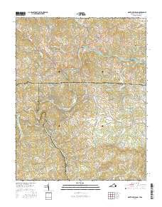
2016 Map of Mouth of Wilson
USGS Topo · Published 2016About this map
The New River meanders across the state line between Virginia and North Carolina, serving as a geographic anchor for the rural communities of Mouth of Wilson, Oak Hill, and Piney Creek. This mountainous borderland is defined by its water systems, where the North Fork New River and South Fork New River converge amidst a landscape of prominent peaks like Fox Knob and Rocky Knob. The settlement pattern follows the river valleys and winding mountain roads, such as Piney Post Office Rd and State Rte 826.
Find a feature on this map
146 named features on this map. Tap any name to fly to it.
Don’t see what you’re looking for? This feature index may not catch every label — zoom into the map to look around manually.
Map Details
Editions of this 2016 Mouth of Wilson Map
This is the sole edition of this map. No revisions or reprints were ever made.
Other maps of this area

1889 · Wytheville
USGS Topo · 1:125,000

1889 · Wilkesboro
USGS Topo · 1:125,000

1891 · Wilkesboro
USGS Topo · 1:125,000

1892 · Wytheville
USGS Topo · 1:125,000

1930 · Independence
USGS Topo · 1:48,000

1933 · Independence
USGS Topo · 1:62,500

1935 · Mouth of Wilson
USGS Topo · 1:48,000
1935 · Trout Dale
USGS Topo · 1:24,000

1935 · Middle Fox Creek
USGS Topo · 1:24,000

1940 · Mouth of Wilson
USGS Topo · 1:62,500