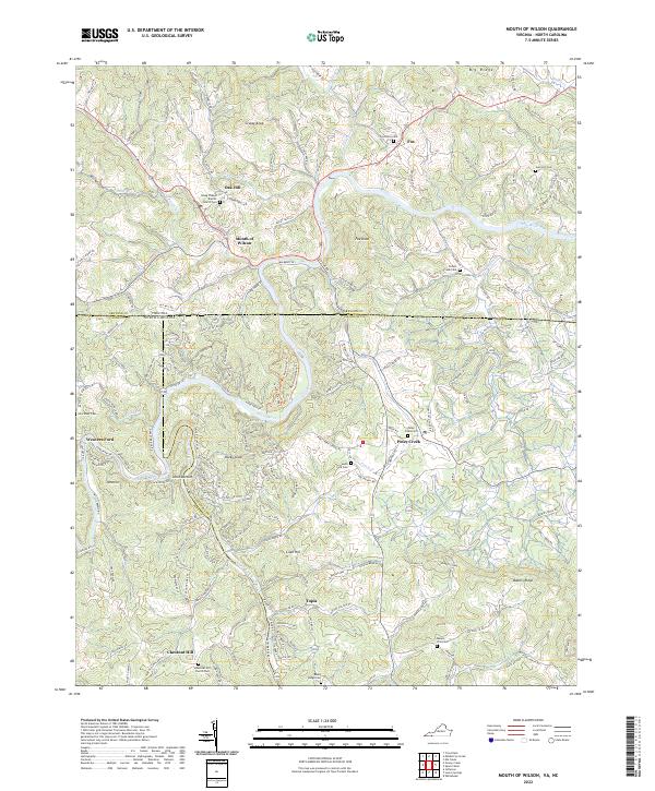
2022 Map of Mouth of Wilson
USGS Topo · Published 2022About this map
Mouth of Wilson and the surrounding borderlands of Grayson County, Virginia, and Ashe and Alleghany Counties, North Carolina, are defined by the winding course of the New River. This map shows the confluence where the North Fork New River and South Fork New River meet at Jacks Bottom, a critical geographic junction in the High Country. The landscape is dotted with small rural communities and family-centered landmarks, such as Oak Hill and Piney Creek. Genealogists will find a high density of burial sites throughout the river valleys, including Gold Hill Cem, Potato Creek Cem, and Fox Union Cem. The rugged terrain is punctuated by high points like Grassy Knob and Fox Knob, while the spiritual life of the area is represented by institutions such as Young Chapel Baptist Church and Mount Zion Ch. The road network reflects the difficult topography, with routes like NC 1309 and State RD 1317 following the natural contours of the ridges and creeks.
Find a feature on this map
55 named features on this map. Tap any name to fly to it.
Don’t see what you’re looking for? This feature index may not catch every label — zoom into the map to look around manually.
Map Details
Editions of this 2022 Mouth of Wilson Map
This is the sole edition of this map. No revisions or reprints were ever made.
Other maps of this area

1889 · Wytheville
USGS Topo · 1:125,000

1889 · Wilkesboro
USGS Topo · 1:125,000

1891 · Wilkesboro
USGS Topo · 1:125,000

1892 · Wytheville
USGS Topo · 1:125,000

1930 · Independence
USGS Topo · 1:48,000

1933 · Independence
USGS Topo · 1:62,500

1935 · Mouth of Wilson
USGS Topo · 1:48,000
1935 · Trout Dale
USGS Topo · 1:24,000

1935 · Middle Fox Creek
USGS Topo · 1:24,000

1940 · Mouth of Wilson
USGS Topo · 1:62,500