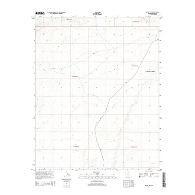
2014 Map of Mowaapi
USGS Topo · Published 2014About this map
Kykotsmovi Village serves as the primary focal point of this 2014 survey, positioned on the edge of the high desert mesas in northeastern Arizona. The landscape is defined by the significant drainage of the Oraibi Wash which cuts through the southern reaches of the quadrangle. The terrain rises to the notable landmark of Mowa`api in the northwest, illustrating the dramatic elevation changes characteristic of the Colorado Plateau. Transportation and access across this tribal land are facilitated by the Bureau of Indian Affairs road network, specifically Bia-2 and Bia-13, which connect the settlement to the broader region. This map provides a clear view of the modern infrastructure and natural topography of the Hopi Reservation before further 21st-century development.
Find a feature on this map
11 named features on this map. Tap any name to fly to it.
Don’t see what you’re looking for? This feature index may not catch every label — zoom into the map to look around manually.
Map Details
Editions of this 2014 Mowaapi Map
This is the sole edition of this map. No revisions or reprints were ever made.
Other maps of this area

1883 · Tusayan
USGS Topo · 1:250,000

1886 · Tusayan
USGS Topo · 1:250,000

1947 · Flagstaff
USGS Topo · 1:250,000

1954 · Flagstaff
USGS Topo · 1:250,000

1958 · Flagstaff
USGS Topo · 1:250,000

1960 · Flagstaff
USGS Topo · 1:250,000

1962 · Flagstaff
USGS Topo · 1:250,000

1966 · Oraibi
USGS Topo · 1:62,500

1966 · Tovar Mesa
USGS Topo · 1:62,500
1967 · Howell Mesa
USGS Topo · 1:24,000