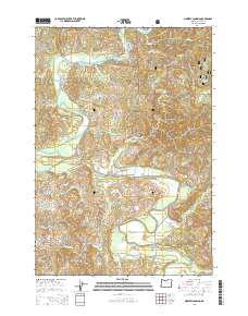
2014 Map of Mowrey Landing
USGS Topo · Published 2014About this map
The Siletz River winds through this coastal Oregon landscape, defining the geographic and cultural heart of the region. As it flows toward the Pacific, the river passes through the historic settlement at Mowrey Landing and beneath the Ojalla Bridge. This 2014 survey documents a territory where public and private lands meet, with significant portions of the Siuslaw National Forest bordering timberlands and family-named roads. The map captures the intricate drainage system of the Coast Range, tracing numerous tributaries such as Euchre Creek, Stemple Cr, and Jaybird Cr. On the higher ground, Little Euchre Mtn stands above the valley, while the broad, level area of Camas Prairie indicates the specific terrain that has historically supported local agriculture and settlement south of the river.
Find a feature on this map
52 named features on this map. Tap any name to fly to it.
Don’t see what you’re looking for? This feature index may not catch every label — zoom into the map to look around manually.
Map Details
Editions of this 2014 Mowrey Landing Map
This is the sole edition of this map. No revisions or reprints were ever made.
Other maps of this area

1941 · Cape Foulweather
USGS Topo · 1:62,500

1942 · Euchre Mtn
USGS Topo · 1:62,500

1942 · Yaquina
USGS Topo · 1:62,500

1942 · Toledo
USGS Topo · 1:62,500

1943 · Euchre Mtn
USGS Topo · 1:62,500

1944 · Cape Foulweather
USGS Topo · 1:62,500

1953 · Salem
USGS Topo · 1:250,000

1954 · Salem
USGS Topo · 1:250,000

1957 · Cape Foulweather
USGS Topo · 1:62,500

1957 · Yaquina
USGS Topo · 1:62,500