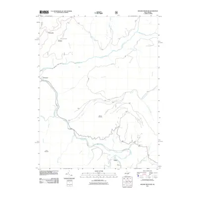
2011 Map of Mozark Mountain
USGS Topo · Published 2011About this map
Mozark Mountain and Backbone Mountain dominate this corner of Tucker County, where high ridges separate the drainages of the Blackwater River and Dry Fork. The landscape is defined by its deep drainage network, featuring numerous mountain runs such as Finley Run, Lindy Run, and the multi-branched Red Run. Settlement is sparse and primarily confined to peripheral locations, including Mackeyville in the northwest and Gladwin in the south near the Teter Cemetery.
Find a feature on this map
36 named features on this map. Tap any name to fly to it.
Don’t see what you’re looking for? This feature index may not catch every label — zoom into the map to look around manually.
Map Details
Editions of this 2011 Mozark Mountain Map
This is the sole edition of this map. No revisions or reprints were ever made.
Other maps of this area

1886 · St. George
USGS Topo · 1:125,000

1889 · Beverly
USGS Topo · 1:125,000

1891 · St. George
USGS Topo · 1:125,000

1892 · Beverly
USGS Topo · 1:125,000

1892 · Franklin
USGS Topo · 1:125,000

1895 · Piedmont
USGS Topo · 1:125,000

1896 · Franklin
USGS Topo · 1:125,000

1908 · Parsons
USGS Topo · 1:62,500

1916 · Davis
USGS Topo · 1:48,000

1918 · Davis
USGS Topo · 1:62,500